Use of AWACS and aerial surveillance
The easy manner in which Indian land frontiers have been breached in recent times by terrorists bent on inflicting damage on military targets in the hinterland begs a case for upgrading aerial component in both the daylight and night-time surveillance, reconnaissance and Intelligence gathering.
That there is dire need to upgrade all aspects of situational awareness is indicated by the delay in discovering air accidents that have occurred in the past involving VVIPs and disappearances of aircraft at sea.
Cumulatively they underscore wide-open gaps in both terrestrial and aerial surveillance and detection capabilities that have contributed to an unease over how well we can defend ourselves in the new hybrid warfare that has been unleashed on us.
Aerial surveillance has many layers and that is why the Government of India constituted in 2010 the Integrated Space Cell to deal with threats to India’s aerospace assets that had emerged with the Chinese experiment in shooting down its own aged satellite with a ground based missile.
The Cell has been nominated the nodal agency under the Integrated Defence Services Headquarters within the Ministry of Defence.
It includes the Army, Navy and Air Force as well as the civilian Department of Space and the Indian Space Research Organisation (ISRO) all of which jointly operate within the Cell.
This kind of integration had become necessary in the interest of jointness and network centricity required to simultaneously protect India’s impressive space-based assets in the satellite communications that are used jointly by the three Services for communications, aircraft and missile guidance while the civilian sector uses the network for communications, disaster management and weather forecasting.
Within this overall infrastructure the increasingly urgent requirement is for facilities to detect infiltration through our land and maritime frontiers, tract Left Wing militancy in the heartland and to vector security forces to intercept and neutralize the threats.
At this terrestrial level the required tools are unmanned aerial vehicles and tethered aerostats. Nonetheless, the feeling is growing that in trying to protect the space assets not enough attention has been paid to terrestrial defences which have been breached time and again at Pathankot, Uri and Nagrota.
It was only after the Uri attack that serious efforts were made to shut the gaps in periphery defences of military installations close to the International Border and the Line of Control.
Time and again it has been stated that the dense foliage along large parts of the Line of Control makes it difficult for Indian patrol parties to detect terrorists hiding in close proximity to the barbed wire fence.
Yet figures released of numbers of terrorists who have managed to infiltrate into Jammu and Kashmir appear to have come from fixed surveillance cameras that were accessed post ipso facto after the terrorists have made a successful infiltration and dispersed into the hinterland to bide their time to strike at their targets.
This indicates that there is no realtime monitoring of these cameras to be able to detect infiltration as it is happening and is thus, preventable.
It seems that the cameras have replaced live personnel and hence the wide gap in detection of infiltration. Often it has been emphasized that counter-insurgency/counter-terrorism are manpower-intensive operations and over- dependence on static defences can be counter-productive.
If the thick tree cover is an impediment, the time is appropriate for the investigating committees to see whether, along with the other paraphernalia that they recommend for acquisition, airborne foliage penetration aids are required for a better perimeter defence.
There are airborne platforms that can carry radars that can seek out human presence hiding under cover of dense foliage.
Powerful sensors
These can help improve situational awareness both during the day and especially in the night. The possibility of laying ambushes to trap the Pakistani terrorist will improve considerably instead of being caught unawares time and again.
In the larger picture, airborne surveillance is also multi-layered. It is used to provide information on realtime deployment of enemy troops and concentration of heavy weapons even while scanning the skies for intruders.
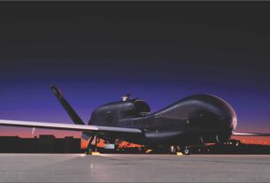
For this India has acquired a large number of unmanned aerial vehicles (UAV) not just for the Army but also the paramilitary forces that play an important role along large parts of the International Border (the Border Security Force).
Tactical UAVs are used to gather information on the enemy through several layers of deployment from the treetop level to the medium altitude long endurance (MALE) unmanned platforms that can stay aloft for as long as 24 hours and more.
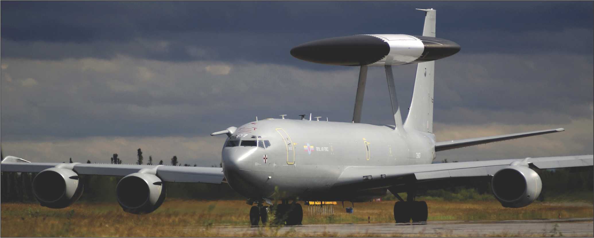
It is to ensure a more secure air defence ground environment system (ADGES) that India has acquired AWACS aircraft to be able to detect impending penetration of hostile aircraft/missiles. It is in the process of acquiring Russian S400 surface-to-air missiles through a deal signed during the BRICS summit in Goa for five systems.
The system has an integral target acquisition radar that will pick up the target at 600 km distance and engage it at 400 km. It can track while scan as many as 80 incoming projectiles (aircraft and missiles).
While this will still take about three years to fructify India is dependent on the three modified Ilyushin transporters that have been converted to the AWACS role with the installation of the Israeli Phalcon radar. Orders for two more were placed at the end of 2016.
In a parallel project the Defence Research and Development Organisation had tied up with Embraer of Brazil for three airborne early warning and command systems aircraft based on the Embraer ERJ-145 platform to supplement the Phalcon fleet bought from Israel.
It is a measure of the need for an adequate number of airborne early warning and command systems aircraft that the Indian Air Force eventually raised the requirement of such aircraft from six to an additional twenty bringing the total to 26.
Given India’s landmass and given an admitted situation of gaps in the radar network such mobile aerial platforms do not only fill the gaps but also supplement the existing air defence ground environment system to ensure a failsafe coverage through network centricity.
Of particular comfort is the fact that many of the systems and subsystems on the airborne early warning and command platforms have been designed and developed by DRDO subsidiary laboratories. Of particular significance is the creation of the planary radiating array which is in pencil-like configuration instead of the conventional dish antenna type of the Ilyushin AWACS.
Given the significantly large numbers of AWACS and Airborne Early Warning and Command Systems aircraft required by the Indian Air Force it would be appropriate that Indian companies like Tata and Mahindra that are vying for joint ventures to produce passenger aircraft in India should tender for supply of such platforms to the DRDO. Apart from the local requirement the possibility of exports are also bright.
In the context of a holistic aerial surveillance network, such surveillance and reconnaissance capability because it is multi-layered must also incorporate the space-based satellite assets.
This brings in the Integrated Space Cell which is vested with the task of protection of India’s space assets but also ensure adequate proliferation in the event of hostility.
In this regard the requirement of a clear picture of the battlefield the appropriate tool would be a satellite in low earth orbit.
For this the Integrated Space Cell should create a stockpile of launch vehicles and small satellites with better than one meter resolution for picture perfect imagery of the battlefield for immediate deployment in an impending emergency.